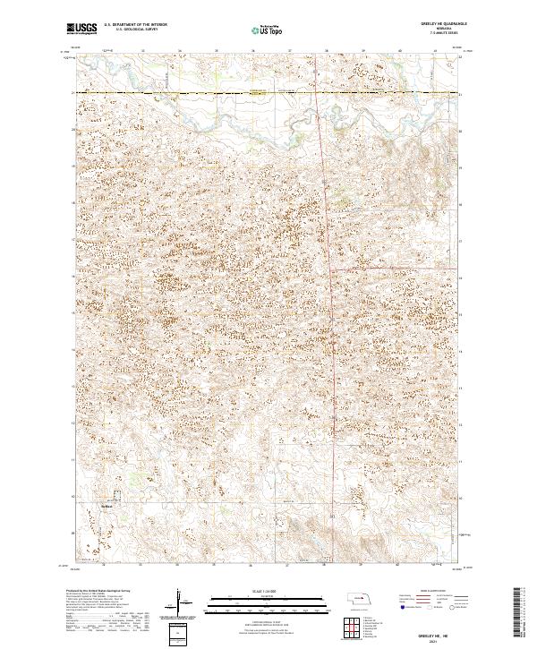
2021 Map of Greeley NE
USGS Topo · Published 2021About this map
Belfast sits near the southwestern edge of this northern Greeley County landscape, situated where the undulating terrain begins to level toward the valley of the Cedar River. The topography is defined by the stabilized dunes and sandy depressions of the eastern Nebraska Sandhills, a characteristic pattern that dictates the placement of the sparse road network. Primary routes such as Ericson Lake Rd and Belfast Rd follow the section lines, though they frequently shift to navigate the natural contours of the land. In the southeastern corner, the drainage of the E Br Spring Cr provides a subtle contrast to the river valley in the northwest. This 2021 update reveals the enduring rural structure of the region, where township and range lines like t20n r11w still define the organization of the land over a century after its initial settlement.
Find a feature on this map
18 named features on this map. Tap any name to fly to it.
Don’t see what you’re looking for? This feature index may not catch every label — zoom into the map to look around manually.
Map Details
Editions of this 2021 Greeley NE Map
This is the sole edition of this map. No revisions or reprints were ever made.
Other maps of this area

1954 · Horace
USGS Topo · 1:24,000

1954 · Greeley NE
USGS Topo · 1:24,000

1954 · Greeley
USGS Topo · 1:24,000

1954 · Greeley NW
USGS Topo · 1:24,000

1954 · Spalding SW
USGS Topo · 1:24,000

1954 · Spalding NW
USGS Topo · 1:24,000

1954 · Bartlett SE
USGS Topo · 1:24,000

1954 · Ericson
USGS Topo · 1:24,000

1955 · Broken Bow
USGS Topo · 1:250,000

1956 · Broken Bow
USGS Topo · 1:250,000