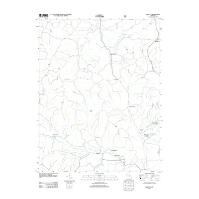
2012 Map of Greeley
USGS Topo · Published 2012About this map
The West Fork Black River and East Fork Huzzah Creek define the drainage patterns of this Ozark landscape, where early 21st-century mining operations contrast with long-established rural settlements. Near the community of Greeley, the terrain is marked by numerous hollows and valleys, including Hodge Hollow, Tarpit Hollow, and Warren Valley. These secluded areas often house family landmarks like Callahan Cemetery and Radford Cemetery, which serve as vital points for genealogical research. To the east, the industrial presence of the Brushy Creek mine is evidenced by the Brushy Creek Mine Water Lake and the Brushy Creek Tailings Dam. Further north, the settlement of Buick sits near the Buick Lookout Tower, overlooking a network of forest roads and the winding Karkaghne Scenic Dr.
Find a feature on this map
37 named features on this map. Tap any name to fly to it.
Don’t see what you’re looking for? This feature index may not catch every label — zoom into the map to look around manually.
Map Details
Editions of this 2012 Greeley Map
This is the sole edition of this map. No revisions or reprints were ever made.
Other maps of this area

1941 · Stone Hill
USGS Topo · 1:62,500

1943 · Boss
USGS Topo · 1:62,500

1944 · Corridon
USGS Topo · 1:62,500

1945 · Stone Hill
USGS Topo · 1:62,500

1945 · Round Spring
USGS Topo · 1:62,500

1946 · Boss
USGS Topo · 1:62,500

1947 · Sinkin
USGS Topo · 1:48,000

1947 · Corridon
USGS Topo · 1:62,500

1949 · Round Spring
USGS Topo · 1:62,500

1949 · Rolla
USGS Topo · 1:250,000