
1954 Map of Greeley
USGS Topo · Published 1966About this map
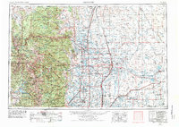
Greeley and the surrounding agricultural plains meet the high peaks of the Rocky Mountains in this mid-century survey of Northern Colorado. The transition from the high-altitude wilderness of Rocky Mountain National Park, anchored by Longs Peak, to the irrigated farm reaches of the South Platte River valley defines the regional landscape. The map captures a critical period of water management and transit, showing the extensive network of irrigation storage including Horsetooth Reservoir, Carter Lake, and the Empire Reservoir. A complex web of rail infrastructure, including the Union Pacific RR, Great Western RR, and Colorado and Southern Ry, connects established centers like Fort Collins, Loveland, and Boulder. This industrial and agricultural backbone supported the growth of the University of Colorado, Colorado State University, and the University of Northern Colorado as central cultural landmarks in their respective communities.
Find a feature on this map
200 named features on this map. Tap any name to fly to it.
Don’t see what you’re looking for? This feature index may not catch every label — zoom into the map to look around manually.
Map Details
Editions of this 1954 Greeley Map
3 editions found
Other maps of this area

1890 · East Denver
USGS Topo · 1:125,000

1895 · Laramie
USGS Topo · 1:125,000

1899 · West Denver
USGS Topo · 1:125,000

1902 · Laramie
USGS Topo · 1:125,000

1902 · Greeley
USGS Topo · 1:125,000

1902 · Boulder
USGS Topo · 1:62,500

1904 · Niwot
USGS Topo · 1:62,500

1904 · Boulder
USGS Topo · 1:62,500

1905 · Sherman
USGS Topo · 1:125,000

1905 · Laramie
USGS Topo · 1:125,000