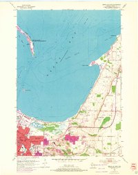
1954 Map of Green Bay East
USGS Topo · Published 1972About this map
The Green Bay shoreline and its developing eastern suburbs define this mid-century landscape, showing the transition from the industrial city center to the rural townships of Scott, Preble, and Humboldt. Significant institutional footprints appear throughout the area, including the sprawling grounds of the University of Wisconsin at Green Bay and the County Hospital complex near County Home Cemetery. To the north, the historic community of Bay Settlement and the small cluster at Wequiock sit atop the rising elevation of Chapel Ridge, overlooking the bay.
Find a feature on this map
41 named features on this map. Tap any name to fly to it.
Don’t see what you’re looking for? This feature index may not catch every label — zoom into the map to look around manually.
Map Details
Editions of this 1954 Green Bay East Map
2 editions found
Other maps of this area

1954 · De Pere
USGS Topo · 1:62,500

1954 · Green Bay West
USGS Topo · 1:24,000

1954 · Denmark
USGS Topo · 1:62,500

1954 · De Pere
USGS Topo · 1:24,000

1954 · New Franken
USGS Topo · 1:62,500

1954 · Green Bay East
USGS Topo · 1:24,000

1954 · Manitowoc
USGS Topo · 1:250,000

1954 · Bellevue
USGS Topo · 1:24,000

1954 · Green Bay
USGS Topo · 1:62,500

1955 · Green Bay
USGS Topo · 1:250,000