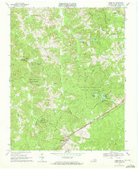
1968 Map of Green Bay
USGS Topo · Published 1972About this map
Prince Edward State Forest dominates much of this landscape, reflecting mid-century conservation and land management efforts in Southside Virginia. The terrain is characterized by a dense network of small watercourses, such as Massie Creek and Sandy Creek, which drain toward the larger systems of Prince Edward Lake and Goodwin Lake. Settlement patterns are largely concentrated around the rail lines that bisect the region, including the Norfolk and Western and the Southern railroads.
Find a feature on this map
37 named features on this map. Tap any name to fly to it.
Don’t see what you’re looking for? This feature index may not catch every label — zoom into the map to look around manually.
Map Details
Editions of this 1968 Green Bay Map
2 editions found
Other maps of this area

1891 · Farmville
USGS Topo · 1:125,000

1893 · Farmville
USGS Topo · 1:125,000

1947 · Roanoke
USGS Topo · 1:250,000

1958 · Farmville
USGS Topo · 1:62,500

1958 · Jetersville
USGS Topo · 1:62,500

1958 · Crewe
USGS Topo · 1:62,500

1958 · Keysville
USGS Topo · 1:62,500

1959 · Roanoke
USGS Topo · 1:250,000

1963 · Roanoke
USGS Topo · 1:250,000
1968 · Farmville
USGS Topo · 1:24,000