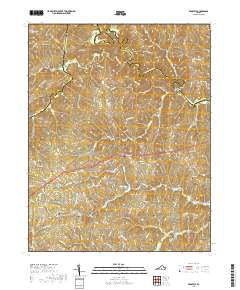
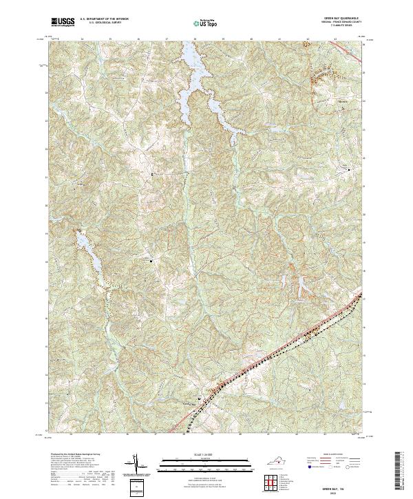
1968 Map of Green Bay
USGS Topo · Published 1975About this map
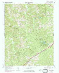
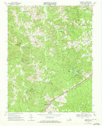
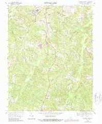
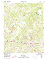
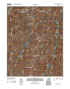
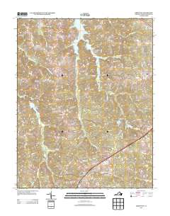
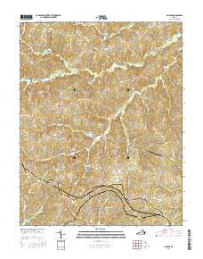
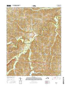
Prince Edward State Forest dominates this Central Virginia landscape, illustrating a region where public timberlands and recreational waters converge with traditional rural settlements. The topography is defined by the drainages of Sandy Creek and Millers Creek, which flow through a series of ridges and valleys. Evidence of community life is anchored by several local congregations, including Sharon Ch and Calvary Ch, alongside the Bagby Mem Ch Cem. In the southern portion of the quadrangle, the village of Green Bay serves as a transportation node where the Southern and Norfolk and Western rail lines intersect. This 1960s survey, with 1970s revisions, highlights the development of Prince Edward and Goodwin Lake State Park, featuring Goodwin Lake and Prince Edward Lake as significant local landmarks for conservation and leisure.
Find a feature on this map
42 named features on this map. Tap any name to fly to it.
Don’t see what you’re looking for? This feature index may not catch every label — zoom into the map to look around manually.
Map Details
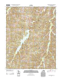
Editions of this 1968 Green Bay Map
2 editions found
Historical Maps of Green Bay Through Time
30 maps found
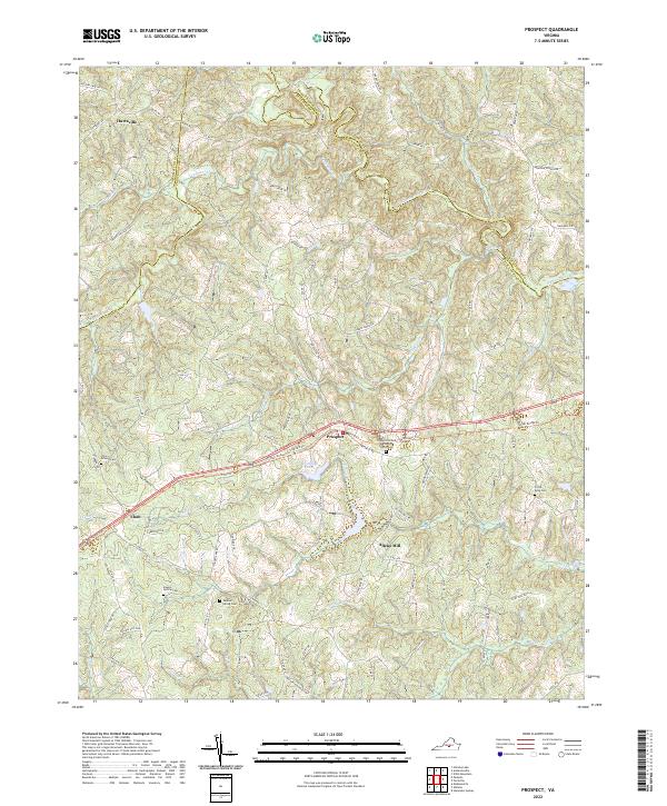
1967 Prospect
Prince Edward County, VA
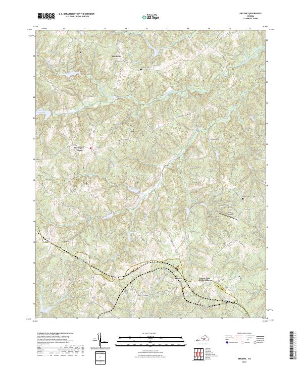
1968 Abilene
Prince Edward County, VA
1968 Green Bay
Prince Edward County, VA
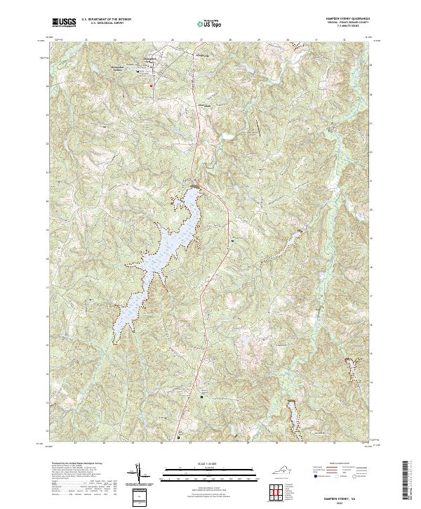
1968 Hampden Sydney
Prince Edward County, VA
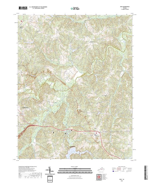
1968 Rice
Prince Edward County, VA
2010 Abilene
Prince Edward County, VA
2010 Green Bay
Prince Edward County, VA
2010 Hampden Sydney
Prince Edward County, VA
2010 Prospect
Prince Edward County, VA
2010 Rice
Prince Edward County, VA
2013 Abilene
Prince Edward County, VA
2013 Green Bay
Prince Edward County, VA
2013 Hampden Sydney
Prince Edward County, VA
2013 Prospect
Prince Edward County, VA
2013 Rice
Prince Edward County, VA
2016 Abilene
Prince Edward County, VA
2016 Green Bay
Prince Edward County, VA
2016 Hampden Sydney
Prince Edward County, VA
2016 Prospect
Prince Edward County, VA
2016 Rice
Prince Edward County, VA
2019 Abilene
Prince Edward County, VA
2019 Green Bay
Prince Edward County, VA
2019 Hampden Sydney
Prince Edward County, VA
2019 Prospect
Prince Edward County, VA
2019 Rice
Prince Edward County, VA
2022 Abilene
Prince Edward County, VA
2022 Green Bay
Prince Edward County, VA
2022 Hampden Sydney
Prince Edward County, VA
2022 Prospect
Prince Edward County, VA
2022 Rice
Prince Edward County, VA