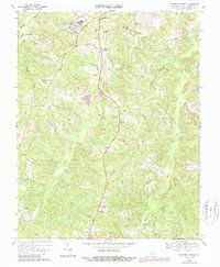
1968 Map of Hampden Sydney
USGS Topo · Published 1987About this map
Hampden-Sydney College serves as the focal point of this landscape in southern Virginia, surrounded by the small rural settlements of Hampden Sydney, Kingsville, and Worsham. The map reveals a community deeply rooted in its academic and religious institutions, with the Seminary Cem and Mercy Seat Ch situated near the campus. The terrain is defined by a dense network of waterways, including Buffalo Creek and the Bush River, which carve through the wooded ridges. Farther south, the rural character is maintained through small crossroads like Redd Shop and scattered houses of worship such as New Wit Ch and Mt Pleasant Ch. This 1960s survey, with updates from the mid-1980s, documents the area's transition while preserving the locations of family landmarks and local cemeteries that define the heritage of Prince Edward County.
Find a feature on this map
29 named features on this map. Tap any name to fly to it.
Don’t see what you’re looking for? This feature index may not catch every label — zoom into the map to look around manually.
Map Details
Editions of this 1968 Hampden Sydney Map
Other maps of this area

1891 · Farmville
USGS Topo · 1:125,000

1892 · Appomattox
USGS Topo · 1:125,000

1893 · Farmville
USGS Topo · 1:125,000

1947 · Roanoke
USGS Topo · 1:250,000

1956 · Charlotte Court House
USGS Topo · 1:62,500

1958 · Farmville
USGS Topo · 1:62,500

1958 · Keysville
USGS Topo · 1:62,500

1958 · Pamplin City
USGS Topo · 1:62,500

1959 · Roanoke
USGS Topo · 1:250,000

1963 · Roanoke
USGS Topo · 1:250,000
Featured Places
- Hampden Sydney, VA
- Kingsville, Hampden Sydney
- Worsham, Hampden Sydney
- Prince Edward County, VA
- United States