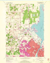
1954 Map of Green Bay West
USGS Topo · Published 1972About this map
The Fox River and Green Bay waterfront anchor this 1950s landscape, which shows the city's westward expansion toward Howard and Hobart. Significant industrial and civic infrastructure is visible, including the Power Plant along the river and the Arena and Lambeau Field to the south. The area is heavily marked by the intersection of the Chicago and North Western and the Chicago Milwaukee St Paul and Pacific railroads, which facilitated the growth of neighborhoods like Cormier and Duck Creek.
Find a feature on this map
74 named features on this map. Tap any name to fly to it.
Don’t see what you’re looking for? This feature index may not catch every label — zoom into the map to look around manually.
Map Details
Editions of this 1954 Green Bay West Map
2 editions found
Other maps of this area

1954 · De Pere
USGS Topo · 1:62,500

1954 · Green Bay West
USGS Topo · 1:24,000

1954 · Denmark
USGS Topo · 1:62,500

1954 · De Pere
USGS Topo · 1:24,000

1954 · New Franken
USGS Topo · 1:62,500

1954 · Green Bay East
USGS Topo · 1:24,000

1954 · Manitowoc
USGS Topo · 1:250,000

1954 · Bellevue
USGS Topo · 1:24,000

1954 · Green Bay
USGS Topo · 1:62,500

1955 · Green Bay
USGS Topo · 1:250,000