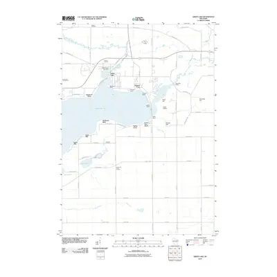
2010 Map of Green Lake
USGS Topo · Published 2010About this map
Green Lake dominates this Wisconsin landscape, serving as the central geographic feature for the surrounding lakeside communities. The city of Green Lake is positioned along the northern shore near the Upper Green Lake Dam and the Puchyan River. This 2010 survey details the extensive residential development of the shoreline, including Sherwood Forest, Oakwood Point, and Forest Glen Beach. These clustered settlements illustrate the area's transition into a prominent recreational and residential destination.
Find a feature on this map
66 named features on this map. Tap any name to fly to it.
Don’t see what you’re looking for? This feature index may not catch every label — zoom into the map to look around manually.
Map Details
Editions of this 2010 Green Lake Map
This is the sole edition of this map. No revisions or reprints were ever made.
Other maps of this area

1915 · Neshkoro
USGS Topo · 1:48,000

1916 · Ripon
USGS Topo · 1:48,000

1918 · Neshkoro
USGS Topo · 1:62,500

1918 · Ripon
USGS Topo · 1:62,500

1955 · Randolph
USGS Topo · 1:62,500

1955 · Fox Lake
USGS Topo · 1:62,500

1956 · Ripon
USGS Topo · 1:62,500

1957 · Madison
USGS Topo · 1:250,000

1960 · Madison
USGS Topo · 1:250,000

1963 · Neshkoro
USGS Topo · 1:62,500
Featured Places
- Green Lake, City of Green Lake
- City of Green Lake, WI
- Brooklyn, WI
- Tuleta Hills, WI
- Green Lake Station, WI