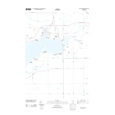
2013 Map of Green Lake
USGS Topo · Published 2013About this map
Green Lake dominates this central Wisconsin landscape, its deep waters and intricate shoreline defining the local development of the early 21st century. The city of Green Lake is situated at the northeastern corner of the lake, where the Puchyan Mill Race and Puchyan River exit the basin. This area shows a transition from structured urban blocks to the residential enclaves that hug the water, including Sherwood Forest, Oakwood Point, and Terrace Beach. These neighborhoods reflect the long-standing appeal of the shoreline for seasonal and permanent residents alike.
Find a feature on this map
81 named features on this map. Tap any name to fly to it.
Don’t see what you’re looking for? This feature index may not catch every label — zoom into the map to look around manually.
Map Details
Editions of this 2013 Green Lake Map
This is the sole edition of this map. No revisions or reprints were ever made.
Other maps of this area

1915 · Neshkoro
USGS Topo · 1:48,000

1916 · Ripon
USGS Topo · 1:48,000

1918 · Neshkoro
USGS Topo · 1:62,500

1918 · Ripon
USGS Topo · 1:62,500

1955 · Randolph
USGS Topo · 1:62,500

1955 · Fox Lake
USGS Topo · 1:62,500

1956 · Ripon
USGS Topo · 1:62,500

1957 · Madison
USGS Topo · 1:250,000

1960 · Madison
USGS Topo · 1:250,000

1963 · Neshkoro
USGS Topo · 1:62,500
Featured Places
- Green Lake, City of Green Lake
- City of Green Lake, WI
- Brooklyn, WI
- Tuleta Hills, WI
- Green Lake Station, WI