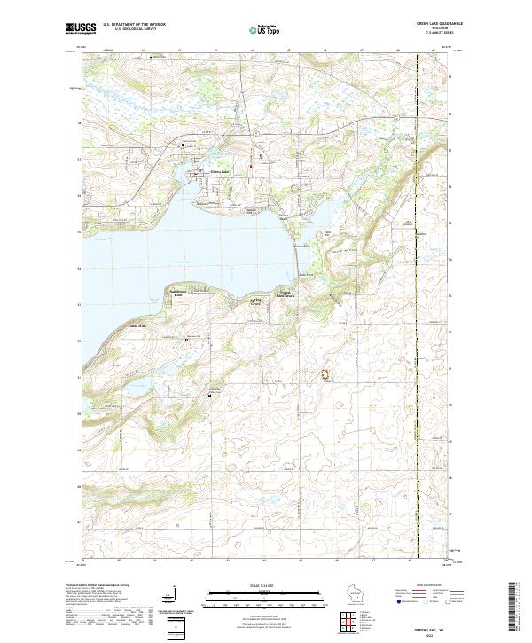
2022 Map of Green Lake
USGS Topo · Published 2022About this map
The northern reaches of Green Lake define this landscape, where the Puchyan River and the Puchyan Mill-Race flow through the city of Green Lake. The shoreline is heavily developed with distinct communities including Oakwood Point, Terrace Beach, and Forest Glen Beach, illustrating the area's long-standing character as a residential and recreation hub. Further south, the terrain rises into the Tuleta Hills and Sandstone Bluff, providing a natural boundary to the glacial lake basin.
Find a feature on this map
100 named features on this map. Tap any name to fly to it.
Don’t see what you’re looking for? This feature index may not catch every label — zoom into the map to look around manually.
Map Details
Editions of this 2022 Green Lake Map
This is the sole edition of this map. No revisions or reprints were ever made.
Other maps of this area

1915 · Neshkoro
USGS Topo · 1:48,000

1916 · Ripon
USGS Topo · 1:48,000

1918 · Neshkoro
USGS Topo · 1:62,500

1918 · Ripon
USGS Topo · 1:62,500

1955 · Randolph
USGS Topo · 1:62,500

1955 · Fox Lake
USGS Topo · 1:62,500

1956 · Ripon
USGS Topo · 1:62,500

1957 · Madison
USGS Topo · 1:250,000

1960 · Madison
USGS Topo · 1:250,000

1963 · Neshkoro
USGS Topo · 1:62,500