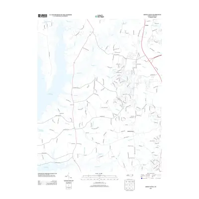
2013 Map of Green Level
USGS Topo · Published 2013About this map
Green Level and Genlee sit at the center of a rapidly evolving landscape where traditional North Carolina rural tracts meet modern suburban development. The western edge is defined by the massive reach of B Everett Jordan Lake, whose inlets and fingers, such as Lick Br and Indian Cr, carve into the terrain. This topography is characterized by a dense network of watercourses including Northeast Cr and White Oak Cr, which flow through areas once dominated by homesteads and farms like the Lassiter Homestead.
Find a feature on this map
177 named features on this map. Tap any name to fly to it.
Don’t see what you’re looking for? This feature index may not catch every label — zoom into the map to look around manually.
Map Details
Editions of this 2013 Green Level Map
This is the sole edition of this map. No revisions or reprints were ever made.
Other maps of this area

1943 · Durham South
USGS Topo · 1:62,500

1946 · Chapel Hill
USGS Topo · 1:24,000

1947 · Chapel Hill
USGS Topo · 1:31,680

1951 · Farrington
USGS Topo · 1:24,000

1951 · Durham South
USGS Topo · 1:62,500

1953 · Raleigh
USGS Topo · 1:250,000

1954 · Raleigh
USGS Topo · 1:250,000

1969 · New Hope Dam
USGS Topo · 1:24,000
1973 · Cary
USGS Topo · 1:24,000
1973 · Green Level
USGS Topo · 1:24,000