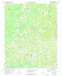
1973 Map of Green Level
USGS Topo · Published 1975About this map
Lake B Everett Jordan dominates the western landscape of this North Carolina quadrangle, its rising waters reshaping the terrain where New Hope Creek and Morgan Creek converge. The topography captured in 1973 reveals a rural region defined by a transition from traditional tobacco farming and timberlands to the encroaching influence of nearby urban centers. Small crossroads communities like Green Level and Genlee serve as anchors for local life, supported by a network of country sanctuaries including Marthas Chapel and White Oak Ch.
Find a feature on this map
35 named features on this map. Tap any name to fly to it.
Don’t see what you’re looking for? This feature index may not catch every label — zoom into the map to look around manually.
Map Details
Editions of this 1973 Green Level Map
2 editions found
Other maps of this area

1943 · Durham South
USGS Topo · 1:62,500

1946 · Chapel Hill
USGS Topo · 1:24,000

1947 · Chapel Hill
USGS Topo · 1:31,680

1951 · Farrington
USGS Topo · 1:24,000

1951 · Durham South
USGS Topo · 1:62,500

1953 · Raleigh
USGS Topo · 1:250,000

1954 · Raleigh
USGS Topo · 1:250,000

1969 · New Hope Dam
USGS Topo · 1:24,000
1973 · Cary
USGS Topo · 1:24,000
1973 · Southwest Durham
USGS Topo · 1:24,000