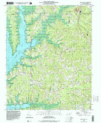
1993 Map of Green Level
USGS Topo · Published 1999About this map
The waters of B Everett Jordan Lake dominate the western edge of this 1993 study, where the inundated valley of New Hope Creek meets a landscape defined by small country congregations and the burgeoning influence of regional development. The intersection of Chatham, Durham, and Wake Counties reveals a transition from traditional rural patterns to more formal preservation, evidenced by the presence of Research Triangle State Park in the northeast. This area preserves a high density of local landmarks vital to genealogists, ranging from Martha Chapel and Holland Chapel in the southwest to O'Kellys Ch near the Durham County line. Settlement centers like Green Level and Genlee are linked by a complex network of tributaries such as Panther Creek, Northeast Creek, and White Oak Creek, illustrating the historical reliance on these drainage basins before modern suburban expansion transformed the surrounding Piedmont.
Find a feature on this map
33 named features on this map. Tap any name to fly to it.
Don’t see what you’re looking for? This feature index may not catch every label — zoom into the map to look around manually.
Map Details
Editions of this 1993 Green Level Map
This is the sole edition of this map. No revisions or reprints were ever made.
Other maps of this area

1943 · Durham South
USGS Topo · 1:62,500

1946 · Chapel Hill
USGS Topo · 1:24,000

1947 · Chapel Hill
USGS Topo · 1:31,680

1951 · Farrington
USGS Topo · 1:24,000

1951 · Durham South
USGS Topo · 1:62,500

1953 · Raleigh
USGS Topo · 1:250,000

1954 · Raleigh
USGS Topo · 1:250,000

1969 · New Hope Dam
USGS Topo · 1:24,000
1973 · Cary
USGS Topo · 1:24,000
1973 · Green Level
USGS Topo · 1:24,000