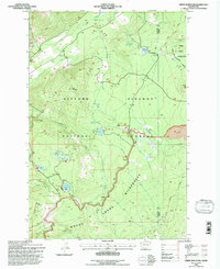
1994 Map of Green Mountain
USGS Topo · Published 1996About this map
Gifford Pinchot National Forest dominates this mid-1990s survey, revealing a landscape defined by high-elevation water and volcanic features. The map captures the meeting point of the Mount Adams Wilderness and the Yakima Indian Reservation, where the topography shifts from the prominent Green Mountain toward the Lava beds in the southeast. Recreation and conservation infrastructure are well-documented, including the high-altitude Pacific Crest National Scenic Trail and specialized sites like Keenes Horse Camp and the Orr Creek Sno-Park.
Find a feature on this map
35 named features on this map. Tap any name to fly to it.
Don’t see what you’re looking for? This feature index may not catch every label — zoom into the map to look around manually.
Map Details
Editions of this 1994 Green Mountain Map
This is the sole edition of this map. No revisions or reprints were ever made.
Other maps of this area

1904 · Mount Adams
USGS Topo · 1:125,000

1907 · Mount Adams
USGS Topo · 1:125,000

1926 · Steamboat Mtn
USGS Topo · 1:125,000

1931 · Steamboat Mtn
USGS Topo · 1:125,000

1950 · Yakima
USGS Topo · 1:250,000

1958 · Yakima
USGS Topo · 1:250,000

1961 · Yakima
USGS Topo · 1:250,000
1970 · Hamilton Buttes
USGS Topo · 1:24,000
1970 · Blue Lake
USGS Topo · 1:24,000
1970 · East Canyon Ridge
USGS Topo · 1:24,000