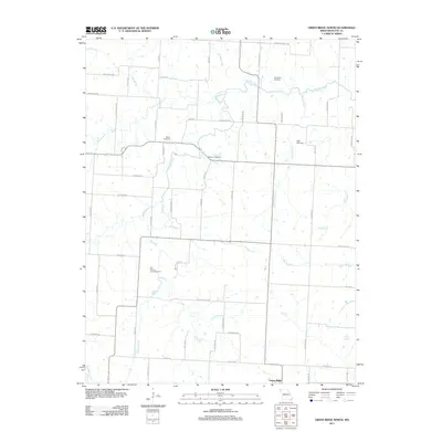
2011 Map of Green Ridge North
USGS Topo · Published 2011About this map
Old Hickory Point Cemetery and several other burial grounds define the ancestral landscape of this northern Pettis County region. The terrain is structured by a dense network of waterways, including Muddy Creek, Elk Fork, and Long Branch, which dictate the placement of early homesteads and road crossings. The settlement of Green Ridge anchors the southern edge of the map, connected to the surrounding countryside by a grid of local routes like Hickory Point Rd and Main Street Rd. Genealogists will find high value in the placement of family-named landmarks such as Rabourn Cemetery, Botts Cemetery, and Craighead Cemetery, which remain preserved amidst the agricultural fields and drainage basins of the West Elk Fork and East Elk Fork.
Find a feature on this map
35 named features on this map. Tap any name to fly to it.
Don’t see what you’re looking for? This feature index may not catch every label — zoom into the map to look around manually.
Map Details
Editions of this 2011 Green Ridge North Map
This is the sole edition of this map. No revisions or reprints were ever made.
Other maps of this area

1885 · Warrensburg
USGS Topo · 1:125,000

1887 · Sedalia
USGS Topo · 1:125,000

1887 · Warrensburg
USGS Topo · 1:125,000

1894 · Sedalia
USGS Topo · 1:125,000

1894 · Warrensburg
USGS Topo · 1:125,000

1917 · Knobnoster
USGS Topo · 1:62,500

1939 · Sweet Springs
USGS Topo · 1:62,500

1940 · Sweet Springs
USGS Topo · 1:62,500

1941 · Sweet Springs
USGS Topo · 1:62,500

1944 · Sedalia West
USGS Topo · 1:24,000