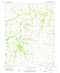
1973 Map of Green Ridge North
USGS Topo · Published 1974About this map
Green Ridge anchors the southern portion of this Missouri landscape, situated where the Missouri - Kansas - Texas railroad cuts through the prairie. This area of Pettis County is defined by a dense network of waterways, most notably the winding course of Muddy Creek and the confluence of the Elk Fork and West Fork Elk Fork. The map provides significant genealogical value through its preservation of numerous small burial grounds associated with early local families, including Craighead Cem, Bethel Cem, and Botts Cem.
Find a feature on this map
28 named features on this map. Tap any name to fly to it.
Don’t see what you’re looking for? This feature index may not catch every label — zoom into the map to look around manually.
Map Details
Editions of this 1973 Green Ridge North Map
This is the sole edition of this map. No revisions or reprints were ever made.
Other maps of this area

1885 · Warrensburg
USGS Topo · 1:125,000

1887 · Sedalia
USGS Topo · 1:125,000

1887 · Warrensburg
USGS Topo · 1:125,000

1894 · Sedalia
USGS Topo · 1:125,000

1894 · Warrensburg
USGS Topo · 1:125,000

1917 · Knobnoster
USGS Topo · 1:62,500

1939 · Sweet Springs
USGS Topo · 1:62,500

1940 · Sweet Springs
USGS Topo · 1:62,500

1941 · Sweet Springs
USGS Topo · 1:62,500

1944 · Sedalia West
USGS Topo · 1:24,000