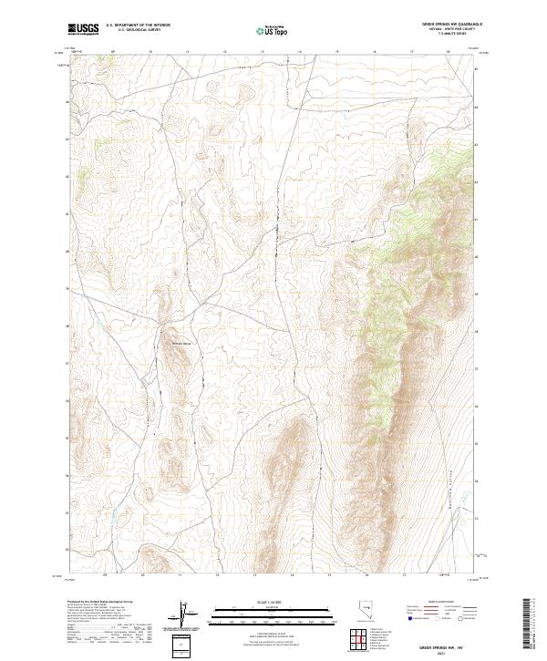
2021 Map of Green Springs NW
USGS Topo · Published 2021About this map
Pancake Range dominates this portion of White Pine County, forming a rugged topographic barrier along the western edge of Railroad Valley. This survey captures a transitional landscape where the desert floor meets the rising elevations of the range, defined by seasonal drainage patterns and wide alluvial fans. Small waterways like Duckwater Cr and Bull Cr navigate the shifting terrain of the valley, indicating the vital water sources that have historically shaped land use and ranching boundaries in this arid region of the Great Basin. The map provides a clear look at the public land survey system divisions, including t16n r55e, t16n r56e, t15n r55e, and t15n r56e, which organize the vast open spaces of the Nevada interior.
Find a feature on this map
8 named features on this map. Tap any name to fly to it.
Don’t see what you’re looking for? This feature index may not catch every label — zoom into the map to look around manually.
Map Details
Editions of this 2021 Green Springs NW Map
This is the sole edition of this map. No revisions or reprints were ever made.
Other maps of this area

1951 · Green Springs
USGS Topo · 1:62,500

1951 · Pancake Summit
USGS Topo · 1:62,500

1953 · Pinto Summit
USGS Topo · 1:62,500

1956 · Ely
USGS Topo · 1:250,000

1959 · Ely
USGS Topo · 1:250,000

1963 · Ely
USGS Topo · 1:250,000

1964 · Moody Peak
USGS Topo · 1:62,500

1979 · Mt. Hamilton
USGS Topo · 1:100,000

1990 · Pancake Summit SW
USGS Topo · 1:24,000
1990 · Green Springs NW
USGS Topo · 1:24,000