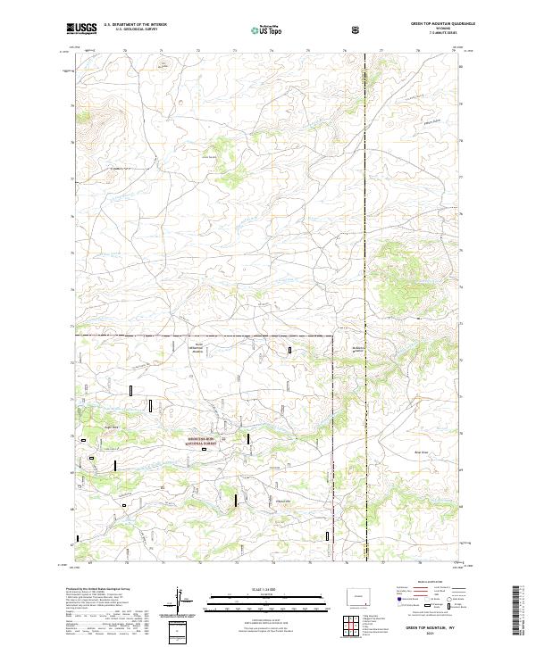
2021 Map of Green Top Mountain
USGS Topo · Published 2021About this map
Medicine Bow National Forest dominates the southern reaches of this landscape, where complex drainage systems like S Lodgepole Creek and Middle Br Middle Lodgepole Creek carve through the high terrain of Albany and Laramie Counties. The map documents a network of service roads and trails, including Eagle Rock Rd and the N Eagle Rock Trl, which provide access to localized landmarks such as Eagle Rock and Pitcher Hill.
Find a feature on this map
34 named features on this map. Tap any name to fly to it.
Don’t see what you’re looking for? This feature index may not catch every label — zoom into the map to look around manually.
Map Details
Editions of this 2021 Green Top Mountain Map
This is the sole edition of this map. No revisions or reprints were ever made.
Other maps of this area

1905 · Sherman
USGS Topo · 1:125,000

1948 · Sherman Mountains
USGS Topo · 1:62,500

1948 · Ragged Top Mountain
USGS Topo · 1:62,500

1950 · Ragged Top Mountain
USGS Topo · 1:62,500

1950 · Sherman Mountains
USGS Topo · 1:62,500

1954 · Cheyenne
USGS Topo · 1:250,000

1958 · Cheyenne
USGS Topo · 1:250,000

1962 · Horse Creek
USGS Topo · 1:24,000
1962 · Hecla
USGS Topo · 1:24,000
1962 · Islay
USGS Topo · 1:24,000