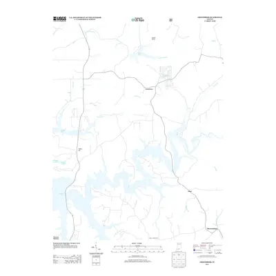
2013 Map of Greenbrier
USGS Topo · Published 2013About this map
Greenbrier and Ethel center this 2013 study of the Indiana landscape, characterized by the irregular, expansive shoreline of Patoka Lake. The reservoir dominates the southern half of the quadrangle, where narrow inlets and coves branch off into drainage ways like Dumplin Br and Cane Br. The terrain north of the lake features a network of smaller water bodies, including Tucker Lake and Wildwood Lake, alongside named rises like Tillery Hill. Local infrastructure is marked by rural road systems connecting the settlements of Brownstown and Newton Stewart. A distinct landmark, the Spears Lookout Tower, stands as a vertical reference point in a region defined by its hydrography and wooded hollows, such as Lomax Hollow. This map documents the modern footprint of the lake's impact on the local geography, showing how contemporary roads and property lines adapt to the winding water's edge.
Find a feature on this map
19 named features on this map. Tap any name to fly to it.
Don’t see what you’re looking for? This feature index may not catch every label — zoom into the map to look around manually.
Map Details
Editions of this 2013 Greenbrier Map
This is the sole edition of this map. No revisions or reprints were ever made.
Other maps of this area

1950 · Valeene
USGS Topo · 1:24,000

1950 · English
USGS Topo · 1:24,000

1951 · Hillham
USGS Topo · 1:24,000

1951 · French Lick
USGS Topo · 1:24,000

1956 · Greenbrier
USGS Topo · 1:24,000

1956 · Taswell
USGS Topo · 1:24,000

1956 · Vincennes
USGS Topo · 1:250,000

1957 · Vincennes
USGS Topo · 1:250,000

1957 · Cuzco
USGS Topo · 1:24,000
1957 · Paoli
USGS Topo · 1:24,000