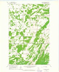
1962 Map of Greenbush SE
USGS Topo · Published 1964About this map
Huss and Como townships define this agricultural landscape in the early 1960s, where the flat terrain of Northern Minnesota is etched with an extensive network of drainage infrastructure. The most significant of these is Judicial Ditch No 19, which cuts through the southern half of the map, illustrating the coordinated efforts required to manage water in the Red River Valley region. This survey highlights the intersection of Roseau and Marshall counties, a boundary that divides the sparsely settled township lands.
Find a feature on this map
8 named features on this map. Tap any name to fly to it.
Don’t see what you’re looking for? This feature index may not catch every label — zoom into the map to look around manually.
Map Details
Editions of this 1962 Greenbush SE Map
This is the sole edition of this map. No revisions or reprints were ever made.
Other maps of this area

1918 · Rollis
USGS Topo · 1:62,500

1918 · Garland
USGS Topo · 1:62,500

1918 · Greenbush
USGS Topo · 1:62,500

1918 · Middle River
USGS Topo · 1:62,500

1943 · Rollis
USGS Topo · 1:62,500

1952 · Thief River Falls
USGS Topo · 1:250,000

1954 · Roseau
USGS Topo · 1:250,000

1956 · Thief River Falls
USGS Topo · 1:250,000

1957 · Roseau
USGS Topo · 1:250,000

1957 · Thief River Falls
USGS Topo · 1:250,000