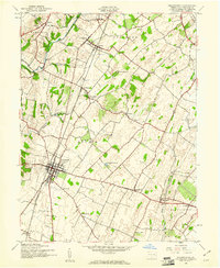
1944 Map of Greencastle
USGS Topo · Published 1961About this map
Greencastle serves as the central hub of this mid-century Franklin County survey, surrounded by a productive landscape of orchards and farmlands. The transport network of the era is clearly defined by the Pennsylvania and Western Maryland railroads, which facilitated the movement of goods between rural outposts like Marion, Kauffman, and Zullinger. Significant water resources include the winding Conococheague Creek in the northwest and the Greencastle Reservoir centrally located within Antrim township.
Find a feature on this map
34 named features on this map. Tap any name to fly to it.
Don’t see what you’re looking for? This feature index may not catch every label — zoom into the map to look around manually.
Map Details
Editions of this 1944 Greencastle Map
4 editions found
Other maps of this area

1900 · Mercersburg
USGS Topo · 1:62,500

1902 · Chambersburg
USGS Topo · 1:62,500

1902 · Mercersburg
USGS Topo · 1:62,500

1909 · Hagerstown
USGS Topo · 1:48,000

1912 · Hagerstown
USGS Topo · 1:62,500

1912 · Williamsport
USGS Topo · 1:62,500

1942 · Hagerstown
USGS Topo · 1:125,000

1943 · Hagerstown
USGS Topo · 1:125,000

1943 · Chambersburg
USGS Topo · 1:62,500

1943 · Mercersburg
USGS Topo · 1:62,500