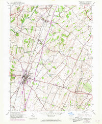
1944 Map of Greencastle
USGS Topo · Published 1968About this map
Greencastle serves as the primary hub of this landscape, where the Penn Central and Western Maryland railroads intersect. This 1944 survey, updated with 1968 aerial revisions, shows a transit corridor in transition, with the older rail infrastructure and local roads augmented by the addition of major interchanges. The agricultural character of the region is punctuated by scattered rural education centers like Clay Hill Sch and Rock Hill Sch, and small settlements such as Shady Grove and Marion.
Find a feature on this map
38 named features on this map. Tap any name to fly to it.
Don’t see what you’re looking for? This feature index may not catch every label — zoom into the map to look around manually.
Map Details
Editions of this 1944 Greencastle Map
4 editions found
Other maps of this area

1900 · Mercersburg
USGS Topo · 1:62,500

1902 · Chambersburg
USGS Topo · 1:62,500

1902 · Mercersburg
USGS Topo · 1:62,500

1909 · Hagerstown
USGS Topo · 1:48,000

1912 · Hagerstown
USGS Topo · 1:62,500

1912 · Williamsport
USGS Topo · 1:62,500

1942 · Hagerstown
USGS Topo · 1:125,000

1943 · Hagerstown
USGS Topo · 1:125,000

1943 · Chambersburg
USGS Topo · 1:62,500

1943 · Mercersburg
USGS Topo · 1:62,500