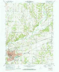
1970 Map of Greencastle
USGS Topo · Published 1977About this map
Greencastle serves as the focal point of this Putnam County landscape, where the campus of De Pauw Univ and the downtown Courthouse define the mid-century civic center. The surrounding terrain is a mix of agricultural utility and established transport corridors, anchored by the Penn Central and Monon railroads. To the north, the small community of Brick Chapel and its associated Brick Chapel Cem mark a long-standing rural hub.
Find a feature on this map
66 named features on this map. Tap any name to fly to it.
Don’t see what you’re looking for? This feature index may not catch every label — zoom into the map to look around manually.
Map Details
Editions of this 1970 Greencastle Map
Other maps of this area

1951 · Clinton Falls
USGS Topo · 1:24,000

1952 · Reelsville
USGS Topo · 1:24,000

1953 · Indianapolis
USGS Topo · 1:250,000

1955 · Russellville
USGS Topo · 1:24,000

1956 · Indianapolis
USGS Topo · 1:250,000

1956 · Cloverdale
USGS Topo · 1:24,000

1956 · Eminence
USGS Topo · 1:24,000

1957 · Indianapolis
USGS Topo · 1:250,000

1958 · Roachdale
USGS Topo · 1:24,000

1958 · Coatesville
USGS Topo · 1:24,000