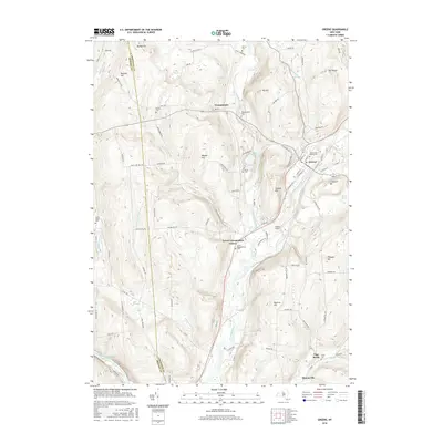
2016 Map of Greene
USGS Topo · Published 2016About this map
The Chenango River valley serves as the central corridor for this 2016 survey, where the town of Greene anchors a landscape defined by significant elevation changes and numerous watercourses. The local geography is marked by distinctive rises such as Juliand Hill and Mt Pisgah, while the valley floor supports the Greene Airport and several hamlets. Smaller settlements like Genegantslet, Lower Genegantslet Corner, and Quinneville are distributed along the tributary systems of Genegantslet Creek and Page Brook.
Find a feature on this map
97 named features on this map. Tap any name to fly to it.
Don’t see what you’re looking for? This feature index may not catch every label — zoom into the map to look around manually.
Map Details
Editions of this 2016 Greene Map
This is the sole edition of this map. No revisions or reprints were ever made.
Other maps of this area

1902 · Coventry
USGS Topo · 1:62,500

1904 · Binghamton
USGS Topo · 1:62,500

1904 · Greene
USGS Topo · 1:62,500

1904 · Oxford
USGS Topo · 1:62,500

1905 · Nineveh
USGS Topo · 1:62,500

1934 · Castle Creek
USGS Topo · 1:24,000

1935 · Chenango Forks
USGS Topo · 1:24,000

1942 · Castle Creek
USGS Topo · 1:31,680

1942 · Chenango Forks
USGS Topo · 1:31,680
1948 · Greene
USGS Topo · 1:24,000