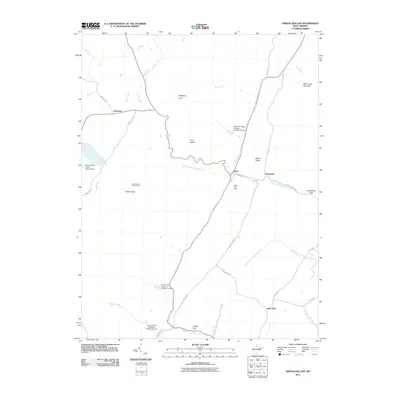
2011 Map of Greenland Gap
USGS Topo · Published 2011About this map
The Allegheny Front and Walker Ridge dominate this section of the Potomac Highlands, where water management and mountainous terrain dictate the pattern of settlement. Smaller communities like Scherr, Bismarck, and Greenland are connected by winding routes such as Scherr Rd and Bismark Rd. The map documents significant infrastructure including the Mount Storm Power Station Dam and several water control structures like Lunice Creek Structure Number 11 Dam and Patterson Creek Structure Number Six Dam.
Find a feature on this map
40 named features on this map. Tap any name to fly to it.
Don’t see what you’re looking for? This feature index may not catch every label — zoom into the map to look around manually.
Map Details
Editions of this 2011 Greenland Gap Map
This is the sole edition of this map. No revisions or reprints were ever made.
Other maps of this area

1895 · Piedmont
USGS Topo · 1:125,000

1899 · Oakland
USGS Topo · 1:62,500

1900 · Oakland
USGS Topo · 1:62,500

1916 · Davis
USGS Topo · 1:48,000

1918 · Davis
USGS Topo · 1:62,500

1919 · Elk Garden
USGS Topo · 1:48,000

1919 · Davis
USGS Topo · 1:62,500

1920 · Elk Garden
USGS Topo · 1:48,000

1920 · Davis
USGS Topo · 1:48,000

1921 · Greenland Gap
USGS Topo · 1:62,500