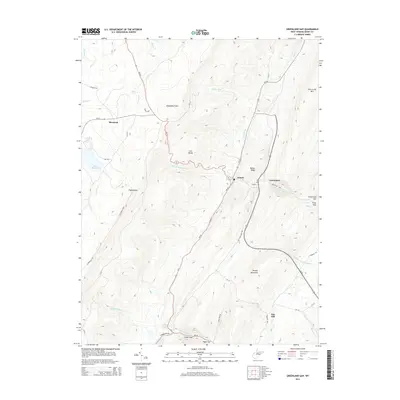
2014 Map of Greenland Gap
USGS Topo · Published 2014About this map
The Allegheny Front dramatically divides this Grant County landscape, creating a series of prominent ridges and gaps that have long dictated the flow of travel and settlement in West Virginia. The small communities of Bismarck, Scherr, and Greenland are positioned along the primary corridors of WV-42 and WV-93, serving as local hubs in a region defined by steep topography. To the east, the terrain is shaped by the parallel heights of New Creek Mtn and Knobly Mountain, while several natural passes, including Greenland Gap, Falls Gap, and Cosner Gap, provide critical east-west transit points through the ridges.
Find a feature on this map
48 named features on this map. Tap any name to fly to it.
Don’t see what you’re looking for? This feature index may not catch every label — zoom into the map to look around manually.
Map Details
Editions of this 2014 Greenland Gap Map
This is the sole edition of this map. No revisions or reprints were ever made.
Other maps of this area

1895 · Piedmont
USGS Topo · 1:125,000

1899 · Oakland
USGS Topo · 1:62,500

1900 · Oakland
USGS Topo · 1:62,500

1916 · Davis
USGS Topo · 1:48,000

1918 · Davis
USGS Topo · 1:62,500

1919 · Elk Garden
USGS Topo · 1:48,000

1919 · Davis
USGS Topo · 1:62,500

1920 · Elk Garden
USGS Topo · 1:48,000

1920 · Davis
USGS Topo · 1:48,000

1921 · Greenland Gap
USGS Topo · 1:62,500