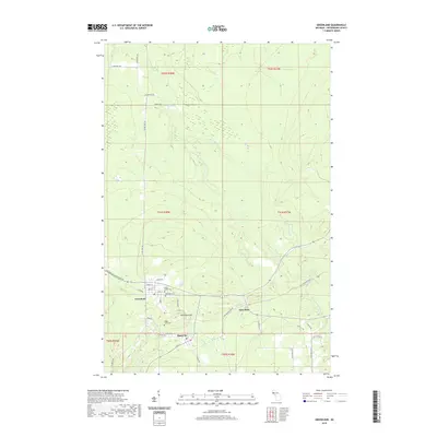
2019 Map of Greenland
USGS Topo · Published 2019About this map
Greenland and Mass City anchor this portion of the Upper Peninsula’s copper country, a landscape defined by industrial history and the branching waters of the Firesteel River. The topography is dominated by the prominent elevation of Adventure Mtn, which sits just east of the primary settlements. To the northeast, the smaller locality of Lake Mine marks a point along the Bill Nicholls Route, a corridor that traces the historic transportation paths through Ontonagon County. Genealogists will find the locations of the Maple Grove Cem and Methodist Cem clearly plotted near the intersection of Plank Rd and Adventure. The drainage network is intricately detailed, showing how the E Br Firesteel River and W Br Firesteel River converge amidst a network of forest roads and early routes like Ontonagon Greenland Rd.
Find a feature on this map
44 named features on this map. Tap any name to fly to it.
Don’t see what you’re looking for? This feature index may not catch every label — zoom into the map to look around manually.
Map Details
Editions of this 2019 Greenland Map
This is the sole edition of this map. No revisions or reprints were ever made.
Other maps of this area

1949 · Rockland
USGS Topo · 1:62,500

1950 · Greenland
USGS Topo · 1:62,500

1951 · Rockland
USGS Topo · 1:62,500

1951 · Greenland
USGS Topo · 1:62,500

1954 · Rousseau
USGS Topo · 1:62,500

1954 · Winona
USGS Topo · 1:62,500

1958 · Iron River
USGS Topo · 1:250,000

1960 · Iron River
USGS Topo · 1:250,000

1961 · Iron River
USGS Topo · 1:250,000

1967 · Iron River
USGS Topo · 1:250,000