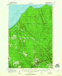
1950 Map of Greenland
USGS Topo · Published 1960About this map
The copper-mining legacy of Michigan's Upper Peninsula is etched across this landscape, centered on the historic settlements of Greenland and Mass. By the mid-20th century, the industrial intensity of the region is evident in the network of logging and mining camps like Abbott-Fox Camp and Hilger Camp scattered through the Baraga State Forest. The map documents a transition in resource extraction, noting several "inactive" sites such as the Adventure Mine and Lake Mine, alongside the active Caledonia Mine.
Find a feature on this map
52 named features on this map. Tap any name to fly to it.
Don’t see what you’re looking for? This feature index may not catch every label — zoom into the map to look around manually.
Map Details
Editions of this 1950 Greenland Map
2 editions found
Other maps of this area

1949 · Rockland
USGS Topo · 1:62,500

1950 · Greenland
USGS Topo · 1:62,500

1951 · Rockland
USGS Topo · 1:62,500

1951 · Greenland
USGS Topo · 1:62,500

1954 · Rousseau
USGS Topo · 1:62,500

1954 · Rockhouse Point
USGS Topo · 1:24,000

1954 · Winona
USGS Topo · 1:62,500

1955 · Ontonagon
USGS Topo · 1:62,500

1956 · Matchwood
USGS Topo · 1:62,500

1958 · Hancock
USGS Topo · 1:250,000