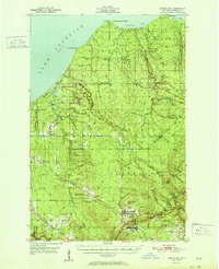
1951 Map of Greenland
USGS Topo · Published 1951About this map
Greenland and the neighboring settlement of Mass serve as the focal points for this mid-century survey of the Ontonagon County copper range. The landscape is defined by the legacy of mineral extraction, illustrated by the Adventure Mine (Inactive), the Caledonia Mine, and a scattered network of shafts. To the north, the terrain transitions into the dense woods of the Ontonagon National Forest and Houghton State Forest, where numerous timber camps like Abbott-Fox Camp and Hilger Camp once operated. Traces of industrial infrastructure are visible in the form of an Old Grade, marking former rail routes that once connected these remote camps to the coastal points of Lake Superior. Along the shore, landmarks such as Fourteenmile Point and Tenmile Point frame the rugged coastline between Tenmile Bay and Misery Bay. The intricate drainage of the Firesteel River and Sleeping River networks provides a clear view of the watershed as it existed before modern forest management altered these corridors.
Find a feature on this map
52 named features on this map. Tap any name to fly to it.
Don’t see what you’re looking for? This feature index may not catch every label — zoom into the map to look around manually.
Map Details
Editions of this 1951 Greenland Map
2 editions found
Other maps of this area

1949 · Rockland
USGS Topo · 1:62,500

1950 · Greenland
USGS Topo · 1:62,500

1951 · Rockland
USGS Topo · 1:62,500

1951 · Greenland
USGS Topo · 1:62,500

1954 · Rousseau
USGS Topo · 1:62,500

1954 · Rockhouse Point
USGS Topo · 1:24,000

1954 · Winona
USGS Topo · 1:62,500

1955 · Ontonagon
USGS Topo · 1:62,500

1956 · Matchwood
USGS Topo · 1:62,500

1958 · Hancock
USGS Topo · 1:250,000