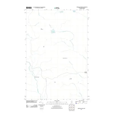
2011 Map of Greenlaw Pond
USGS Topo · Published 2011About this map
The Machias River winds through this section of the Maine interior, defining a landscape of complex waterways and timberland in the early twenty-first century. The presence of Orcutts Camp and crossings like Greenlaw Crossing and Russell Crossing suggests the continued importance of this area for traditional woods work and recreation. High ground is marked by prominent peaks including Greenlaw Mountain and Bald Mountain, while the drainage system is anchored by the central Greenlaw Pond. Access to this remote Aroostook County terrain is provided by primary forest arteries such as Realty Rd and Foster Rand Rd. The map illustrates a network of brooks and streams, including Moosehorn Stream and McConnell Brook, that feed into the larger river systems, reflecting the hydrology of the North Woods.
Find a feature on this map
17 named features on this map. Tap any name to fly to it.
Don’t see what you’re looking for? This feature index may not catch every label — zoom into the map to look around manually.
Map Details
Editions of this 2011 Greenlaw Pond Map
This is the sole edition of this map. No revisions or reprints were ever made.
Other maps of this area

1928 · Winterville
USGS Topo · 1:48,000

1930 · Greenlaw
USGS Topo · 1:48,000

1931 · Fish River Lake
USGS Topo · 1:48,000

1931 · Mooseleuk Lake
USGS Topo · 1:48,000

1931 · Winterville
USGS Topo · 1:62,500

1933 · Greenlaw
USGS Topo · 1:62,500

1935 · Fish River Lake
USGS Topo · 1:62,500

1935 · Mooseleuk Lake
USGS Topo · 1:62,500

1954 · Presque Isle
USGS Topo · 1:250,000

1958 · Presque Isle
USGS Topo · 1:250,000
Featured Places
- Greenlaw Crossing, T12 R7 WELS
- Russell Crossing, T11 R8 WELS
- T11 R7 WELS, ME
- T12 R8 WELS, ME
- T11 R8 WELS, ME