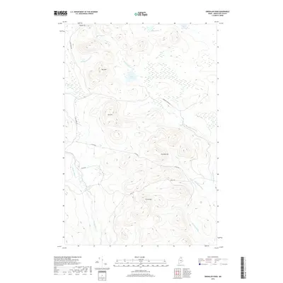
2018 Map of Greenlaw Pond
USGS Topo · Published 2018About this map
Greenlaw Pond sits at the heart of this North Maine Woods landscape, surrounded by a complex network of streams and significant peaks. The terrain is defined by a series of prominent elevations, including Bishop Mtn, Bald Mtn, and Bull Hill, which overlook the headwaters of the Machias River and Greenlaw Stream. This 2018 survey illustrates the heavy reliance on private industrial access, with routes like Realty Rd and Rocky Brook Rd providing the primary transportation corridors through the township of t12 r8 Wels. The map reveals the intricate hydrology of the region, from the smaller Moose Pond and Bishop Pond to the meandering courses of Moosehorn Stream and McConnell Brook, showing how the land remains centered on timber management and watershed conservation.
Find a feature on this map
18 named features on this map. Tap any name to fly to it.
Don’t see what you’re looking for? This feature index may not catch every label — zoom into the map to look around manually.
Map Details
Editions of this 2018 Greenlaw Pond Map
This is the sole edition of this map. No revisions or reprints were ever made.
Other maps of this area

1928 · Winterville
USGS Topo · 1:48,000

1930 · Greenlaw
USGS Topo · 1:48,000

1931 · Fish River Lake
USGS Topo · 1:48,000

1931 · Mooseleuk Lake
USGS Topo · 1:48,000

1931 · Winterville
USGS Topo · 1:62,500

1933 · Greenlaw
USGS Topo · 1:62,500

1935 · Fish River Lake
USGS Topo · 1:62,500

1935 · Mooseleuk Lake
USGS Topo · 1:62,500

1954 · Presque Isle
USGS Topo · 1:250,000

1958 · Presque Isle
USGS Topo · 1:250,000
Featured Places
- Greenlaw Crossing, T12 R7 WELS
- Russell Crossing, T11 R8 WELS
- T11 R7 WELS, ME
- T12 R8 WELS, ME
- T11 R8 WELS, ME