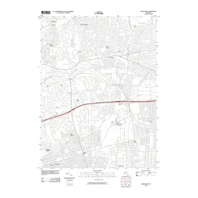
2010 Map of Greenlawn
USGS Topo · Published 2010About this map
Greenlawn and East Northport anchor the northern edge of this Long Island landscape, characterized by the dense suburban residential patterns and major transportation corridors of the early 21st century. The map documents a significant network of parkways, including the Northern State Pkwy and Sagtikos State Pkwy, which intersect near the Pilgrim State Psychiatric Cemetery. This area serves as a transit-oriented hub where the Long Island railroad line connects established communities like Wyandanch and Deer Park. Beyond the suburban sprawl, the geography is defined by the Half Hollow Hills and the headwaters of the Carlls River. Genealogists and local historians will find value in the various burial grounds marked throughout the quadrangle, such as Holy Cross Cemetery and Carll Cemetery, reflecting the area's deep-rooted community history amid modern developments.
Find a feature on this map
47 named features on this map. Tap any name to fly to it.
Don’t see what you’re looking for? This feature index may not catch every label — zoom into the map to look around manually.
Map Details
Editions of this 2010 Greenlawn Map
This is the sole edition of this map. No revisions or reprints were ever made.
Other maps of this area

1901 · Babylon
USGS Topo · 1:62,500

1901 · Northport
USGS Topo · 1:62,500

1902 · Setauket
USGS Topo · 1:62,500

1902 · Fire Island
USGS Topo · 1:62,500

1903 · Babylon
USGS Topo · 1:62,500

1903 · Northport
USGS Topo · 1:62,500

1903 · Fire Island
USGS Topo · 1:62,500

1904 · Setauket
USGS Topo · 1:62,500

1904 · Islip
USGS Topo · 1:125,000

1919 · Setauket
USGS Topo · 1:62,500