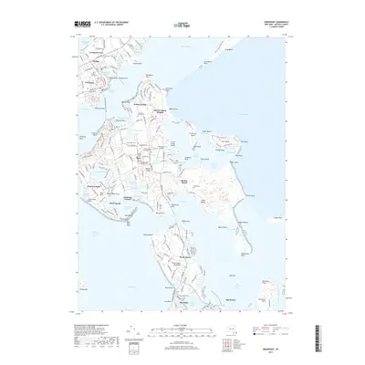
2019 Map of Greenport
USGS Topo · Published 2019About this map
Shelter Island dominates this maritime landscape, surrounded by the waters of Gardiners Bay, Noyack Bay, and Shelter Island Sound. The island’s distinct communities, such as Shelter Island Heights and Dering Harbor, are characterized by a network of local roads and numerous cemeteries that speak to the long-standing residents of the area. These include the Quaker Cem, Saint Mary's Episcopal Cem, and the Shelter Island Presbyterian Cem. To the north, the village of Greenport and the settlement of Stirling serve as the mainland connection, linked to the island via the Shelter Island North Ferry. The map documents a landscape defined by its inlets and points, from West Neck Bay to the aviation sites at Klenawicus Airfield and Westmoreland Airport. This modern survey details the intricate shoreline and the settled interior of these Peconic Bay islands before any further 21st-century development.
Find a feature on this map
201 named features on this map. Tap any name to fly to it.
Don’t see what you’re looking for? This feature index may not catch every label — zoom into the map to look around manually.
Map Details
Editions of this 2019 Greenport Map
This is the sole edition of this map. No revisions or reprints were ever made.
Other maps of this area

1903 · Sag Harbor
USGS Topo · 1:62,500

1903 · Gardiners Island
USGS Topo · 1:62,500

1904 · Sag Harbor
USGS Topo · 1:62,500

1904 · Shelter Island
USGS Topo · 1:62,500

1904 · Easthampton
USGS Topo · 1:62,500

1904 · Gardiners Island
USGS Topo · 1:62,500

1921 · Gardiners Island
USGS Topo · 1:62,500

1921 · Easthampton
USGS Topo · 1:62,500

1944 · Gardiners Island West
USGS Topo · 1:24,000

1946 · Sag Harbor
USGS Topo · 1:24,000