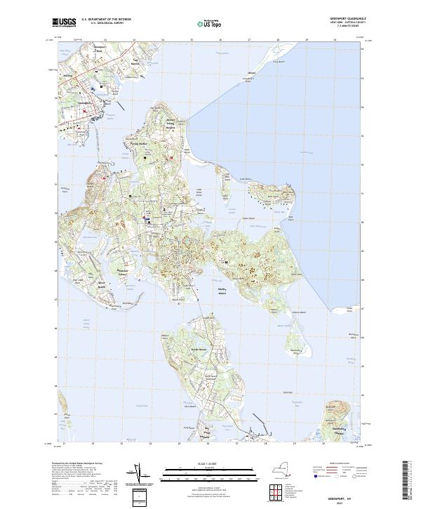
2023 Map of Greenport
USGS Topo · Published 2023About this map
Shelter Island dominates this maritime landscape, anchored between the north and south forks of Long Island's east end. The geography is defined by a complex network of protected coves and points, where Dering Harbor and Shelter Island Heights face the bustling village of Greenport across Shelter Island Sound. This modern record reveals a community where historical preservation is etched into the land through numerous memorial sites, including the Quaker Cem and Saint Mary's Episcopal Cem.
Find a feature on this map
209 named features on this map. Tap any name to fly to it.
Don’t see what you’re looking for? This feature index may not catch every label — zoom into the map to look around manually.
Map Details
Editions of this 2023 Greenport Map
This is the sole edition of this map. No revisions or reprints were ever made.
Other maps of this area

1903 · Sag Harbor
USGS Topo · 1:62,500

1903 · Gardiners Island
USGS Topo · 1:62,500

1904 · Sag Harbor
USGS Topo · 1:62,500

1904 · Shelter Island
USGS Topo · 1:62,500

1904 · Easthampton
USGS Topo · 1:62,500

1904 · Gardiners Island
USGS Topo · 1:62,500

1921 · Gardiners Island
USGS Topo · 1:62,500

1921 · Easthampton
USGS Topo · 1:62,500

1944 · Gardiners Island West
USGS Topo · 1:24,000

1946 · Sag Harbor
USGS Topo · 1:24,000