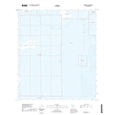
2020 Map of Greens Bayou
USGS Topo · Published 2020About this map
Lone Pine sits at the northeastern edge of a vast wetland landscape dominated by the complex hydrology of Cameron Parish. The terrain is defined by a intricate system of waterways, where natural bayous and human-engineered canals intersect. The Black Bayou and its tributaries, including the Right Prong Black Bayou and the East Fork of Right Prong Black Bayou, drain the northern sections of the map, while Greens Bayou and Greens Lake anchor the central wetlands. Small rises in elevation are marked by features such as Pines Ridge and the Blue Islands, which provide a subtle contrast to the surrounding marsh. The presence of the Starks North Canal and Starks Central Canal highlights the systematic drainage and water management efforts required to navigate and utilize this low-lying coastal environment near the Gulf of Mexico.
Find a feature on this map
19 named features on this map. Tap any name to fly to it.
Don’t see what you’re looking for? This feature index may not catch every label — zoom into the map to look around manually.
Map Details
Editions of this 2020 Greens Bayou Map
This is the sole edition of this map. No revisions or reprints were ever made.
Other maps of this area

1932 · Orange
USGS Topo · 1:62,500

1932 · Port Arthur NE
USGS Topo · 1:31,680

1934 · Johnsons Bayou
USGS Topo · 1:24,000

1934 · Peveto Beach
USGS Topo · 1:24,000

1934 · Greens Bayou
USGS Topo · 1:24,000

1934 · Five Lakes
USGS Topo · 1:24,000

1935 · Peveto Beach
USGS Topo · 1:31,680

1935 · Five Lakes
USGS Topo · 1:31,680

1935 · Greens Bayou
USGS Topo · 1:31,680

1935 · Johnsons Bayou
USGS Topo · 1:31,680