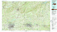
1984 Map of Greensboro
USGS Topo · Published 1984About this map
Guilford Courthouse National Military Park serves as a historical anchor in this mid-1980s portrait of the North Carolina Piedmont, where urban centers like Greensboro and Burlington are increasingly connected by a maturing road network. The landscape is defined by its water management systems, including Lake Townsend, Lake Brandt, and the Stony Creek Reservoir, which support the region's post-war growth. To the north and west, the Dan River and Mayo River carve through the terrain near industrial centers like Eden and Mayodan.
Find a feature on this map
138 named features on this map. Tap any name to fly to it.
Don’t see what you’re looking for? This feature index may not catch every label — zoom into the map to look around manually.
Map Details
Editions of this 1984 Greensboro Map
This is the sole edition of this map. No revisions or reprints were ever made.
Other maps of this area

1923 · Danville
USGS Topo · 1:48,000

1924 · Martinsville
USGS Topo · 1:48,000

1924 · Draper
USGS Topo · 1:48,000

1925 · Danville
USGS Topo · 1:62,500

1926 · Martinsville
USGS Topo · 1:62,500

1926 · Critz
USGS Topo · 1:48,000

1926 · Draper
USGS Topo · 1:62,500

1927 · Martinsville
USGS Topo · 1:62,500

1928 · Critz
USGS Topo · 1:62,500

1943 · Durham South
USGS Topo · 1:62,500