2021 Map of Greenview
USGS Topo · Published 2021About this map
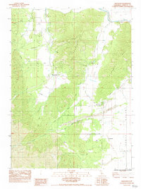
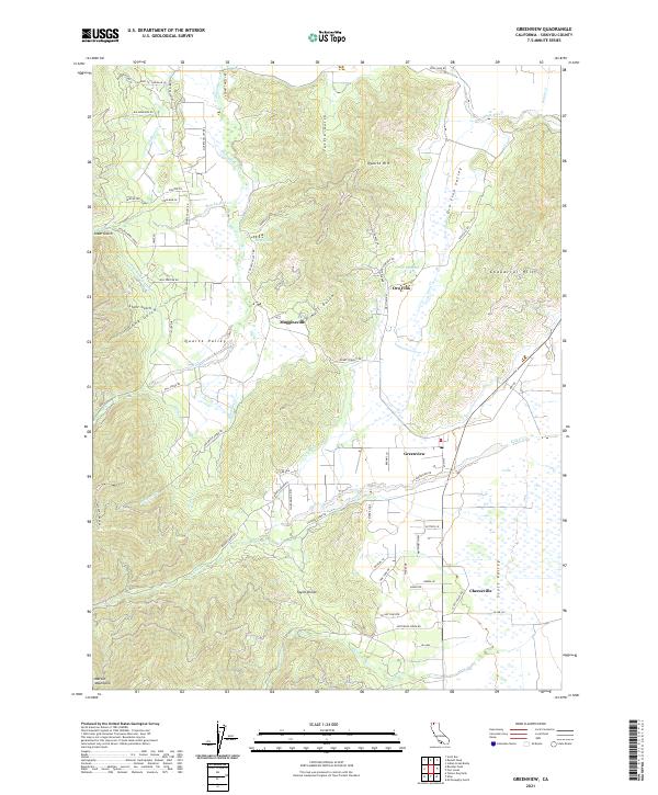
Scott Valley serves as the central pastoral corridor of this Siskiyou County landscape, where agriculture and water management have long dictated the pattern of life. The small settlements of Greenview, Mugginsville, and Cheeseville dot the valley floor, connected by an intricate system of irrigation features like the Shackleford Ditch, Custer Ditch, and Fretis Ditch. These waterways divert flows from the surrounding peaks, including the eastern edges of the Marble Mountains, to support the valley's ranches. To the north, the terrain rises toward Quartz Hill and Chaparral Hill, overlooking the Scott River and the small mountain community of Oro Fino. This modern survey details how historical land divisions and resource extraction sites have evolved into a network of rural lanes and residential pockets, maintaining the area's identity as a remote yet deeply cultivated mountain basin.
Find a feature on this map
119 named features on this map. Tap any name to fly to it.
Don’t see what you’re looking for? This feature index may not catch every label — zoom into the map to look around manually.
Map Details
Editions of this 2021 Greenview Map
This is the sole edition of this map. No revisions or reprints were ever made.
Historical Maps of Oro Fino Through Time
3 maps found