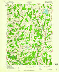
1945 Map of Greenville
USGS Topo · Published 1960About this map
The boundary between Albany and Greene Counties defines the landscape of this 1945 survey, captured just as the region’s agricultural character remained deeply intact. The map centers on the village of Greenville, showing a network of rural hubs like Norton Hill and West Greenville linked by emerging road classifications. Water resources are a prominent feature, dominated by the Basic Creek Reservoir and the winding course of Catskill Creek in the south near Thorp Creek. These waterways and their surrounding valleys provided the foundation for local settlement patterns that have persisted for generations.
Find a feature on this map
29 named features on this map. Tap any name to fly to it.
Don’t see what you’re looking for? This feature index may not catch every label — zoom into the map to look around manually.
Map Details
Editions of this 1945 Greenville Map
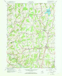
2 editions found
Other maps of this area

1893 · Coxsackie
USGS Topo · 1:62,500

1893 · Durham
USGS Topo · 1:62,500

1893 · Albany
USGS Topo · 1:62,500

1894 · Coxsackie
USGS Topo · 1:62,500

1894 · Durham
USGS Topo · 1:62,500

1895 · Albany
USGS Topo · 1:62,500

1898 · Albany
USGS Topo · 1:62,500

1900 · Berne
USGS Topo · 1:62,500

1903 · Berne
USGS Topo · 1:62,500

1927 · Albany
USGS Topo · 1:62,500