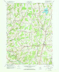
1945 Map of Greenville
USGS Topo · Published 1973About this map
Greenville and the surrounding borderlands of Albany and Greene Counties are captured here just after World War II, showing a landscape defined by small agrarian hamlets and the essential flow of Basic Creek. The north is anchored by the Basic Creek Reservoir, while the southern reaches follow the meandering path of Catskill Creek near the town of Durham. This 1945 fieldwork reveals the late-stage rural schoolhouse system, including School No 6 and School No 3, before the full consolidation of districts.
Find a feature on this map
28 named features on this map. Tap any name to fly to it.
Don’t see what you’re looking for? This feature index may not catch every label — zoom into the map to look around manually.
Map Details
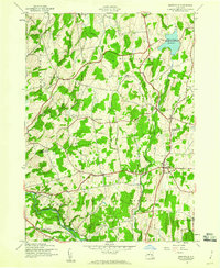
Editions of this 1945 Greenville Map
2 editions found
Other maps of this area

1893 · Coxsackie
USGS Topo · 1:62,500

1893 · Durham
USGS Topo · 1:62,500

1893 · Albany
USGS Topo · 1:62,500

1894 · Coxsackie
USGS Topo · 1:62,500

1894 · Durham
USGS Topo · 1:62,500

1895 · Albany
USGS Topo · 1:62,500

1898 · Albany
USGS Topo · 1:62,500

1900 · Berne
USGS Topo · 1:62,500

1903 · Berne
USGS Topo · 1:62,500

1927 · Albany
USGS Topo · 1:62,500