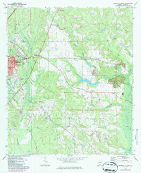
1971 Map of Greenville East
USGS Topo · Published 1986About this map
Greenville serves as the focal point of this Butler County landscape, showing the city's eastern growth during the early 1970s. The map highlights key local institutions like Lomax-Hannon Jr College and South Side High Sch, alongside civic landmarks such as the Courthouse. Moving east from the city center, the terrain transitions into a patchwork of rural homesteads and family-named landmarks. The presence of several country churches, including Ebenezer East Ch, Mt Olive Ch, and St Paul Ch, reflects the social fabric of the surrounding communities like Mashville and Spring Hill.
Find a feature on this map
34 named features on this map. Tap any name to fly to it.
Don’t see what you’re looking for? This feature index may not catch every label — zoom into the map to look around manually.
Map Details
Editions of this 1971 Greenville East Map
2 editions found
Other maps of this area

1953 · Andalusia
USGS Topo · 1:250,000

1957 · Andalusia
USGS Topo · 1:250,000

1971 · Greenville West
USGS Topo · 1:24,000

1971 · Pigeon Creek
USGS Topo · 1:24,000

1971 · Fort Deposit
USGS Topo · 1:24,000

1971 · Honoraville
USGS Topo · 1:24,000

1971 · Fort Dale
USGS Topo · 1:24,000

1971 · Moodys Crossroads
USGS Topo · 1:24,000

1971 · Greenville East
USGS Topo · 1:24,000

1971 · Danielsville
USGS Topo · 1:24,000