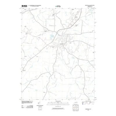
2010 Map of Greenville
USGS Topo · Published 2010About this map
Greenville serves as the central hub of this Muhlenberg County landscape, where the modern developments of Country Side Estates No 1 and the Muhlenberg County Airport sit alongside older settlements like Luzerne and Depoy. The topography is defined by a dense network of watercourses, including Caney Creek, Pond Creek, and the winding path of Sandlick Creek. Genealogists will find a significant concentration of burial grounds, ranging from the large Evergreen Cemetery and West End Cemetery in town to smaller family sites such as the Lee Cemetery, Allen Cemetery, and Williams Cemetery further afield. Transportation routes like the Wendell H Ford Western KY Pkwy bisect the northern region, while older thoroughfares like Sharon Depoy Rd and Luzerne Depot Rd hint at the area's rail-and-road heritage. The eastern boundary is marked by the distinctive Buck Knob, rising above the confluence of creeks and runs that feed into the local river systems.
Find a feature on this map
64 named features on this map. Tap any name to fly to it.
Don’t see what you’re looking for? This feature index may not catch every label — zoom into the map to look around manually.
Map Details
Editions of this 2010 Greenville Map
This is the sole edition of this map. No revisions or reprints were ever made.
Other maps of this area

1909 · Madisonville
USGS Topo · 1:62,500

1909 · Central City
USGS Topo · 1:62,500

1911 · Drakesboro
USGS Topo · 1:48,000

1912 · Nortonville
USGS Topo · 1:62,500

1913 · Drakesboro
USGS Topo · 1:62,500

1952 · Greenville
USGS Topo · 1:24,000

1953 · Drakesboro
USGS Topo · 1:24,000

1953 · Haleys Mill
USGS Topo · 1:24,000

1953 · Rosewood
USGS Topo · 1:24,000

1953 · Central City West
USGS Topo · 1:24,000