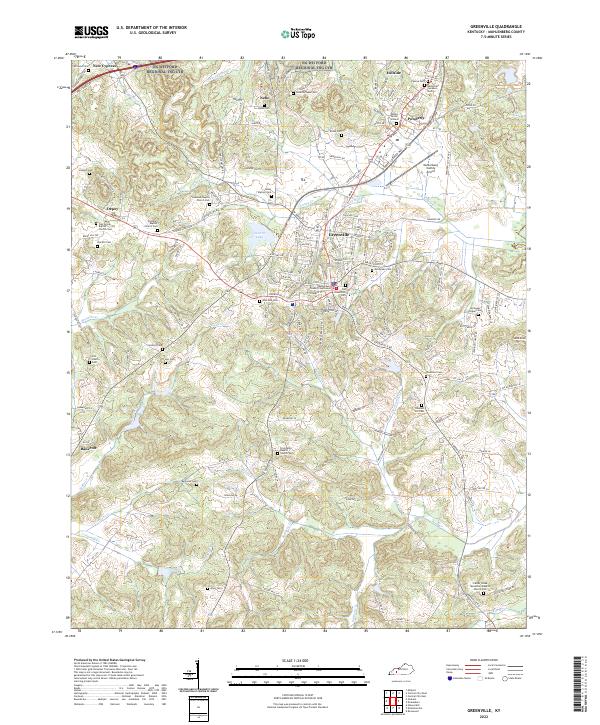
2022 Map of Greenville
USGS Topo · Published 2022About this map
The Muhlenberg County Courthouse stands as the central landmark of Greenville, surrounded by a landscape defined by small settlements and numerous rural burying grounds. This 2022 survey captures the community distribution across Muhlenberg, showing how local infrastructure like the Muhlenberg County Airport and Luzerne Lake integrate with traditional crossroads settlements. The map is particularly valuable for genealogical research, documenting dozens of family and community sites such as Caney Station Cem, Waters Burial Ground, and the Old Greenville Cem.
Find a feature on this map
161 named features on this map. Tap any name to fly to it.
Don’t see what you’re looking for? This feature index may not catch every label — zoom into the map to look around manually.
Map Details
Editions of this 2022 Greenville Map
This is the sole edition of this map. No revisions or reprints were ever made.
Historical Maps of Nebo Through Time
4 maps found