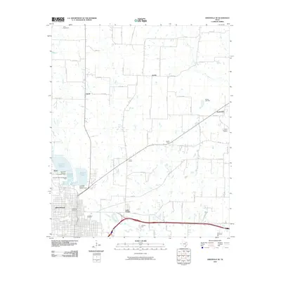
2010 Map of Greenville NE
USGS Topo · Published 2010About this map
The Cowleech Fork Sabine River and its various tributaries define the landscape of this corner of Hunt County, providing the water source for an extensive system of municipal reservoirs northwest of the city center. Greenville serves as the primary anchor, with its industrial and civic core evidenced by the Greenville Post Office Building and residential expansions into Ardis Heights. The periphery is characterized by a network of smaller rural communities and historic stopping points, including the crossroads of Jacobia and Tidwell, as well as Neylandville to the east. Local history is deeply embedded in the terrain through sites like East Mount Cemetery and the Shady Grove Community Hall. Small-scale aviation and recreational sites, such as Card Aerodrome and Jacobia Field, appear alongside the region's agricultural infrastructure and county road network.
Find a feature on this map
64 named features on this map. Tap any name to fly to it.
Don’t see what you’re looking for? This feature index may not catch every label — zoom into the map to look around manually.
Map Details
Editions of this 2010 Greenville NE Map
This is the sole edition of this map. No revisions or reprints were ever made.
Other maps of this area

1953 · Texarkana
USGS Topo · 1:250,000

1954 · Sherman
USGS Topo · 1:250,000

1956 · Texarkana
USGS Topo · 1:250,000

1958 · Sherman
USGS Topo · 1:250,000

1962 · Greenville NW
USGS Topo · 1:24,000

1962 · Greenville SW
USGS Topo · 1:24,000

1962 · Greenville SE
USGS Topo · 1:24,000

1962 · Lone Oak North
USGS Topo · 1:24,000

1963 · Greenville NE
USGS Topo · 1:24,000

1964 · Commerce South
USGS Topo · 1:24,000