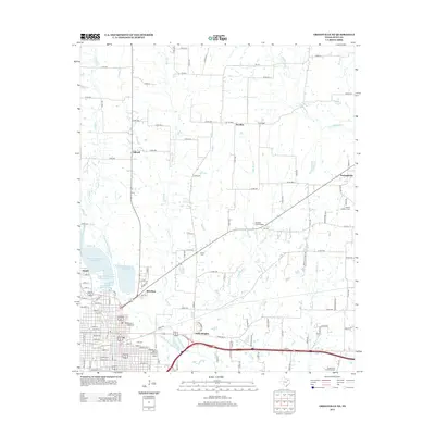
2013 Map of Greenville NE
USGS Topo · Published 2013About this map
The Cowleech Fork Sabine River and its numerous tributaries, including Horse Cr and Wolf Cr, shape the landscape northeast of Greenville. This 2013 survey documents a network of small residential clusters and agricultural communities such as Peniel, Reavilon, and Ardis Heights situated near the headwaters of the Sabine. The local infrastructure is defined by a series of water management features, notably Greenville Reservoir Number Six and its adjacent numbered basins, which suggest a transition from open prairie to controlled utility land. Rural landmarks and burial sites like Liberty Cem and Hopkins Number 1 Cem provide important reference points for family researchers, while the Jacobia Field Airport near Jacobia and the Shady Grove Community Hall reflect the community centers of Hunt County in the early 21st century.
Find a feature on this map
94 named features on this map. Tap any name to fly to it.
Don’t see what you’re looking for? This feature index may not catch every label — zoom into the map to look around manually.
Map Details
Editions of this 2013 Greenville NE Map
This is the sole edition of this map. No revisions or reprints were ever made.
Other maps of this area

1953 · Texarkana
USGS Topo · 1:250,000

1954 · Sherman
USGS Topo · 1:250,000

1956 · Texarkana
USGS Topo · 1:250,000

1958 · Sherman
USGS Topo · 1:250,000

1962 · Greenville NW
USGS Topo · 1:24,000

1962 · Greenville SW
USGS Topo · 1:24,000

1962 · Greenville SE
USGS Topo · 1:24,000

1962 · Lone Oak North
USGS Topo · 1:24,000

1963 · Greenville NE
USGS Topo · 1:24,000

1964 · Commerce South
USGS Topo · 1:24,000