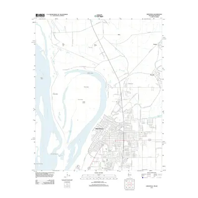
2012 Map of Greenville
USGS Topo · Published 2012About this map
The Mississippi River carves a dramatic path through this 2012 survey, defining the western edge of Greenville and shaping the low-lying terrain of Tarpley Neck and Archer Island. This riverfront landscape is marked by complex hydraulic features including Bachelor Bend, Miller Bend, and the Leland Cutoff Revetment. The urban layout of Greenville reflects its delta heritage, with a dense street grid punctuated by several culturally significant burial grounds, such as the Jewish Cem, Chinese Cem, and Live Oaks Cem. To the north and east, the map traces the transition from the city core to smaller settlements like Metcalfe and Brighton. This edition captures a modern infrastructure layer including Abide Airport and Fairfield Airport, set against the timeless, shifting hydrography of the river valley, where water bodies like Blue Hole Lake and Archer Lake sit within the wide alluvial plain.
Find a feature on this map
200 named features on this map. Tap any name to fly to it.
Don’t see what you’re looking for? This feature index may not catch every label — zoom into the map to look around manually.
Map Details
Editions of this 2012 Greenville Map
This is the sole edition of this map. No revisions or reprints were ever made.
Other maps of this area

1933 · Lamont
USGS Topo · 1:62,500

1939 · Refuge
USGS Topo · 1:62,500

1939 · Lamont
USGS Topo · 1:62,500

1939 · Tralake
USGS Topo · 1:62,500

1939 · Choctaw
USGS Topo · 1:62,500

1953 · Greenwood
USGS Topo · 1:250,000

1956 · Greenwood
USGS Topo · 1:250,000

1967 · Arcola
USGS Topo · 1:24,000

1967 · Stringtown
USGS Topo · 1:24,000

1967 · Leland
USGS Topo · 1:24,000