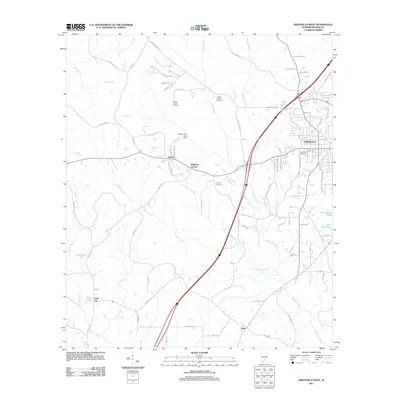
2011 Map of Greenville West
USGS Topo · Published 2011About this map
Greenville serves as the eastern anchor of this Butler County landscape, where the residential and industrial outskirts of the city meet a rural expanse defined by intricate water systems. The terrain is carved by the converging waters of Beaver Creek, Peavy Creek, and Stallings Creek, which flow through a network of small ponds and reservoirs including Lake Greenville and F H Morgan Lake. Genealogists will find significant local history in the distribution of family-named landmarks and burial grounds, such as the William Seale Cemetery and Magnolia Cemetery. The map also captures several distinct settlements and named locales that characterize the area's development outside the city center, including Liberty, Reddock Springs, and the interestingly named Sand Cut. These clusters are connected by a mix of established routes like McMurphy Road and Manningham Road, illustrating the post-war expansion and the enduring rural character of central Alabama.
Find a feature on this map
86 named features on this map. Tap any name to fly to it.
Don’t see what you’re looking for? This feature index may not catch every label — zoom into the map to look around manually.
Map Details
Editions of this 2011 Greenville West Map
This is the sole edition of this map. No revisions or reprints were ever made.
Other maps of this area

1953 · Andalusia
USGS Topo · 1:250,000

1957 · Andalusia
USGS Topo · 1:250,000

1971 · Greenville West
USGS Topo · 1:24,000

1971 · Pigeon Creek
USGS Topo · 1:24,000

1971 · Fort Deposit
USGS Topo · 1:24,000

1971 · Fort Dale
USGS Topo · 1:24,000

1971 · Greenville East
USGS Topo · 1:24,000

1971 · Georgiana East
USGS Topo · 1:24,000

1971 · Georgiana West
USGS Topo · 1:24,000

1981 · Forest Home
USGS Topo · 1:24,000