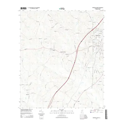
2014 Map of Greenville West
USGS Topo · Published 2014About this map
Greenville sits at the eastern edge of this Butler County landscape, serving as a hub for the surrounding rural communities. The terrain is defined by a dense network of tributaries including Wolf Cr and Stallings Cr, which feed into larger basins like Lake Greenville and F H Morgan Lake. The area's social history is visible through a high density of local burial grounds, ranging from the large Magnolia Cem near the city center to smaller family and community sites such as William Seale Cem and Giddens Chapel Cem. Small settlements like Reddock Springs and Sand Cut are connected by a web of local routes including Manningham Rd and the Pineapple HWY. This 2014 survey reveals a transition from the structured street grid of the county seat to the dispersed agricultural and creek-side dwellings that characterize the western reaches of the quadrangle.
Find a feature on this map
111 named features on this map. Tap any name to fly to it.
Don’t see what you’re looking for? This feature index may not catch every label — zoom into the map to look around manually.
Map Details
Editions of this 2014 Greenville West Map
This is the sole edition of this map. No revisions or reprints were ever made.
Other maps of this area

1953 · Andalusia
USGS Topo · 1:250,000

1957 · Andalusia
USGS Topo · 1:250,000

1971 · Greenville West
USGS Topo · 1:24,000

1971 · Pigeon Creek
USGS Topo · 1:24,000

1971 · Fort Deposit
USGS Topo · 1:24,000

1971 · Fort Dale
USGS Topo · 1:24,000

1971 · Greenville East
USGS Topo · 1:24,000

1971 · Georgiana East
USGS Topo · 1:24,000

1971 · Georgiana West
USGS Topo · 1:24,000

1981 · Forest Home
USGS Topo · 1:24,000