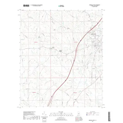
2018 Map of Greenville West
USGS Topo · Published 2018About this map
Greenville serves as the eastern anchor for this Butler County landscape, where the residential streets of the county seat meet a network of rural crossroads and family cemeteries. Small, historically significant settlements like Liberty and Reddock Springs are situated amidst a terrain defined by the headwaters of numerous creeks, including Wolf Creek and Beaver Creek. The map provides a detailed view of local burial grounds that serve as vital links for genealogical research, such as the William Seale Cemetery and Giddens Chapel Cemetery. In the south, the settlement of Wald sits near the winding course of Hawkins Creek, illustrating the dispersed residential patterns common to this part of Alabama. The area's water resources are well-represented by named bodies like Lake Greenville, Speirs Pond, and Lake Charold, reflecting both municipal and private land use during this period.
Find a feature on this map
112 named features on this map. Tap any name to fly to it.
Don’t see what you’re looking for? This feature index may not catch every label — zoom into the map to look around manually.
Map Details
Editions of this 2018 Greenville West Map
This is the sole edition of this map. No revisions or reprints were ever made.
Other maps of this area

1953 · Andalusia
USGS Topo · 1:250,000

1957 · Andalusia
USGS Topo · 1:250,000

1971 · Greenville West
USGS Topo · 1:24,000

1971 · Pigeon Creek
USGS Topo · 1:24,000

1971 · Fort Deposit
USGS Topo · 1:24,000

1971 · Fort Dale
USGS Topo · 1:24,000

1971 · Greenville East
USGS Topo · 1:24,000

1971 · Georgiana East
USGS Topo · 1:24,000

1971 · Georgiana West
USGS Topo · 1:24,000

1981 · Forest Home
USGS Topo · 1:24,000