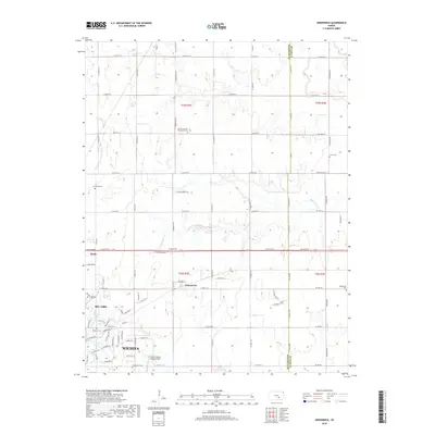
2018 Map of Greenwich
USGS Topo · Published 2018About this map
Wichita's northeastern suburban expansion meets the agricultural landscape of Sedgwick and Butler counties in this 2018 survey. The settlement of Greenwich serves as a central point between the developing residential areas of Bel Aire and the wide-open township sections to the east. Infrastructure like the Colonel James Jabara Airport marks the transition from urban to rural use, while the drainage of Whitewater Creek and Middle Fork Chisholm Creek dictates the local topography. Genealogists will find a high concentration of burial sites across this quadrangle, including the Old Benton, Union, and Greenwich cemeteries, alongside the Lorraine Avenue Mennonite Cemetery, reflecting the area's deep-rooted community history.
Find a feature on this map
50 named features on this map. Tap any name to fly to it.
Don’t see what you’re looking for? This feature index may not catch every label — zoom into the map to look around manually.
Map Details
Editions of this 2018 Greenwich Map
This is the sole edition of this map. No revisions or reprints were ever made.
Other maps of this area

1889 · Wichita
USGS Topo · 1:125,000

1894 · Wichita
USGS Topo · 1:125,000

1941 · Valley Center
USGS Topo · 1:31,680

1942 · Valley Center
USGS Topo · 1:31,680

1943 · Wichita East
USGS Topo · 1:31,680

1945 · Andover
USGS Topo · 1:31,680

1955 · Santa Fe Lake
USGS Topo · 1:24,000

1955 · Benton
USGS Topo · 1:24,000

1955 · Greenwich
USGS Topo · 1:24,000

1955 · Wichita
USGS Topo · 1:250,000